The cooler weather is giving Vilnius residents a break from the summer heat. But as the climate changes, urban heat islands – places where temperatures are significantly warmer than ambient – are becoming a problem. ID Vilnius is developing a virtual map application called Heat Island Radar for Vilnius City Municipality. It will help to identify the hottest spots in the city and take appropriate solutions to mitigate the heat island effect and its impact on the population.
Data collection by drone
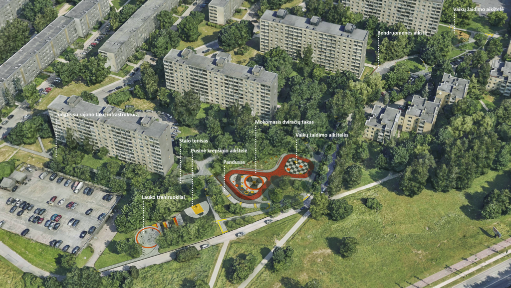
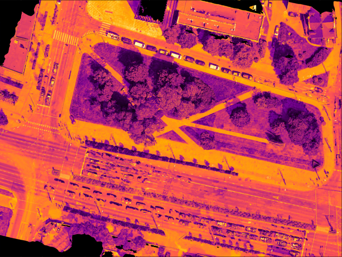
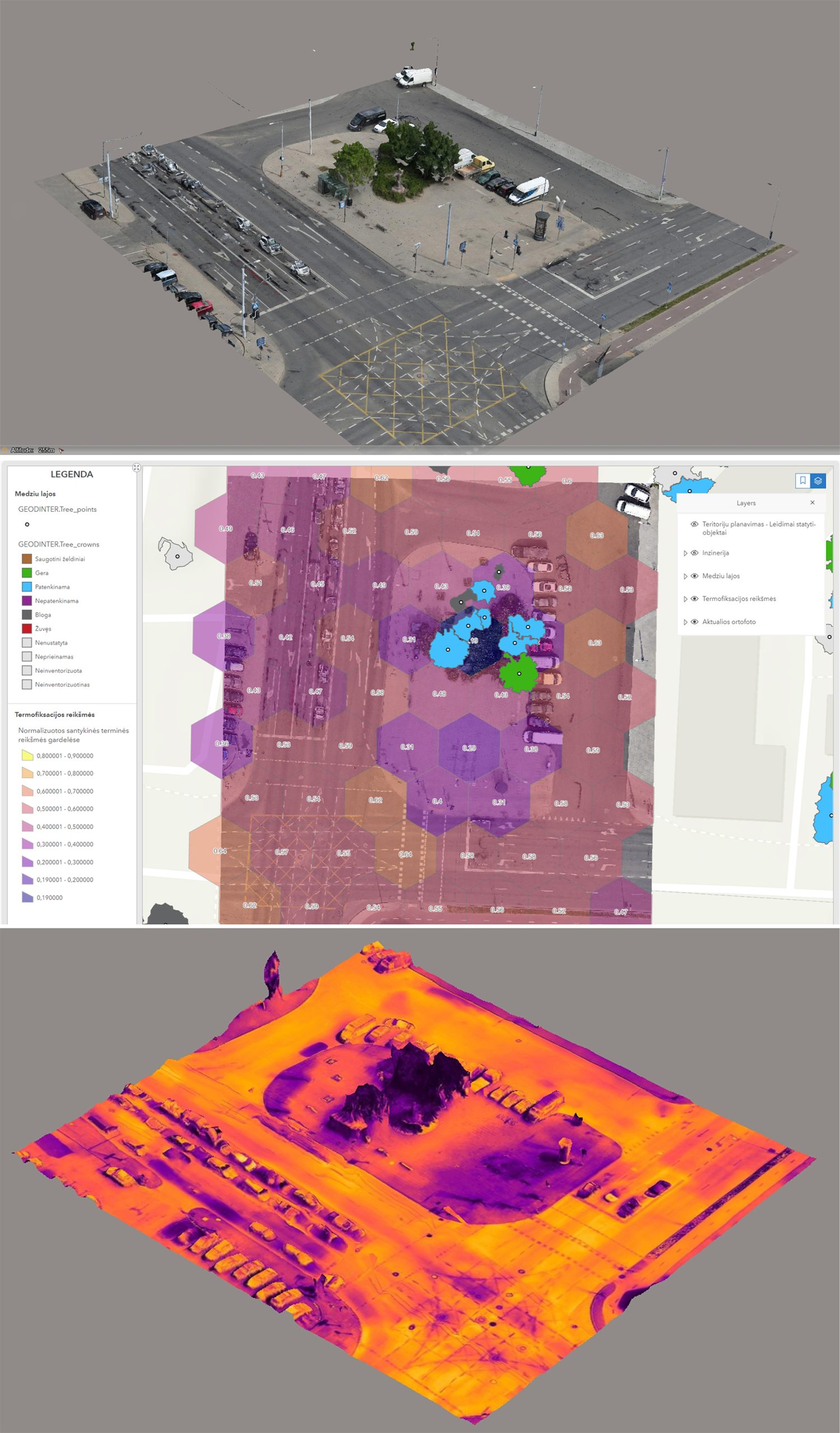
Data on the temperature of urban skies and surfaces will be collected by a drone with an integrated thermal imaging camera. The data will be analysed and processed by ID Vilnius data analysts and displayed on a virtual map. The app will not only show the highest and lowest temperatures in a given area at different times of the day, but also the average temperature. “The technology has been tested together with urban planners and the results have shown that data-driven solutions can help to address the heat island effect of hard surfaces in cities in a more targeted way,” says Žygimantas Pagalys, Product Manager at ID Vilnius. The first scans have already been carried out this summer in Bronius Laurinavičius Square. By the end of September, 10 priority areas where changes are planned or where temperatures are expected to be particularly high in summer will be scanned. Measurements will continue next year. Thereafter, it is planned to take temperature measurements in streets and public spaces every summer, when the problem of heat islands is most evident.
Data-driven decisions
Once the data has been collected and uploaded to the app, it will initially identify the hottest areas in the city’s public spaces. In the next phase, artificial intelligence will be used to generate various green infrastructure solutions in a simulated virtual environment: resurfacing, planting, etc. The simulations will show which solutions would best cool down hot surfaces. Additional measurements will be taken once the changes have been implemented. This will allow the effectiveness of the implemented measures to be monitored. “We will analyse what infrastructure measures or planting solutions the city can take to reduce the heat island effect in the most problematic areas. We will also be able to plan how to help the city’s citizens withstand the summer heat by taking measures such as water columns, misting systems or similar measures,” says Laura Kairienė, Chief Architect of Vilnius City Municipality. The data collected will be made available to specialists for the time being, and will be made available to the public later.
Heat islands – a threat to populations
Heat islands are created when the environment of urbanised areas – buildings, surfaces such as asphalt and concrete – absorb, retain and then radiate heat, resulting in urban temperatures that are significantly higher than those of the surrounding countryside. And the increasing frequency of heat waves and tropical nights, when temperatures do not cool below 20 C at night, only exacerbate the problem. Heat causes serious health problems, increases energy consumption and makes life more difficult for urban dwellers. High temperatures in the city cause heat strokes and dehydration in the population. This is particularly dangerous for the elderly, children and those suffering from chronic diseases or respiratory illnesses. Heat islands have a negative impact on urban flora and fauna, reducing biodiversity.