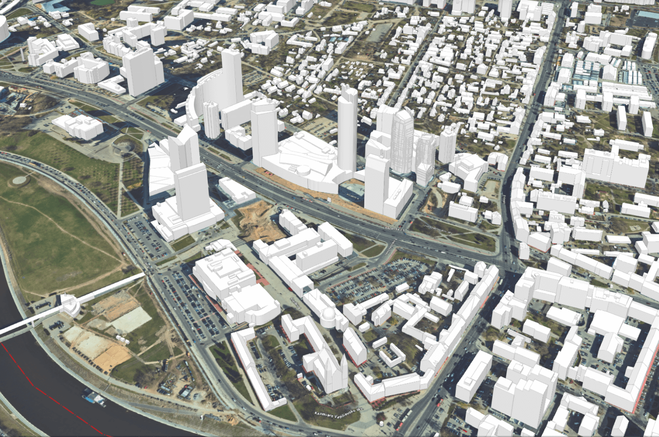
A three-dimensional map of the real situation allows you to see the city virtually, but also to assess the changes taking place in the city. The interactive map helps you see the public spaces, housing, roads and other projects planned in your area. Everyone can see the projects that are underway and planned and assess their importance to the quality of life. The interactive map helps you see the public spaces, housing, roads and other projects planned in your area. Everyone has the opportunity to see the projects underway and planned, and to assess their importance for their quality of life.
The 3D city map allows the municipality and the design and real estate companies, as well as all those who contribute to the city’s well-being, to understand the impact that planned projects will have on the city’s development and on the well-being of its citizens.
Five interactive maps are presented to the public:
Realistic 3D model – presents the current situation of the city, giving an insight into its changes and development directions
3D city layout – detailed representations of buildings and objects in the city.
Oblique aerial images – showing the area and its features from different angles. You can see the park next to your home from different angles.
Design proposals and technical designs – information on the design and design of new buildings
Solar Potential – provides general information on solar radiation indicators, allowing you to estimate the solar potential of your office building or apartment block.