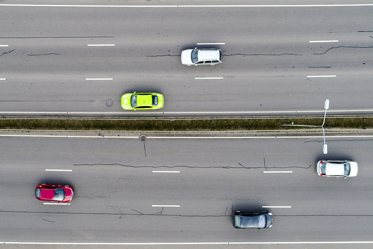
In the past year, almost 1,200 kilometres of the capital’s streets have been scanned by a specialised vehicle with laser scanning equipment. For the second year in a row, the highly accurate scanning results have allowed us to assess the condition of the asphalt pavement of Vilnius streets and to prioritise the sections to be treated accordingly. “To upgrade as many of the capital’s streets as possible in a very short space of time, we do it in a high-quality way, so that you don’t have to return to the same places in a year or two. Objective, data-driven decisions on street repairs allow us to plan more efficiently for continuous asphalting works and save around 5% of the money spent on street repairs,” says Vilnius Mayor Valdas Benkunskas. In 2023, 105.6 km of continuous asphalt will be resurfaced in Vilnius, with a total of €64 million spent on the work. Based on the information from the scan, work will continue this year.
The street surface scanning work is initiated by the municipality-owned company UAB Grinda, while the data processing and system development work is carried out by ID Vilnius in cooperation with Vilnius Gediminas Technical University
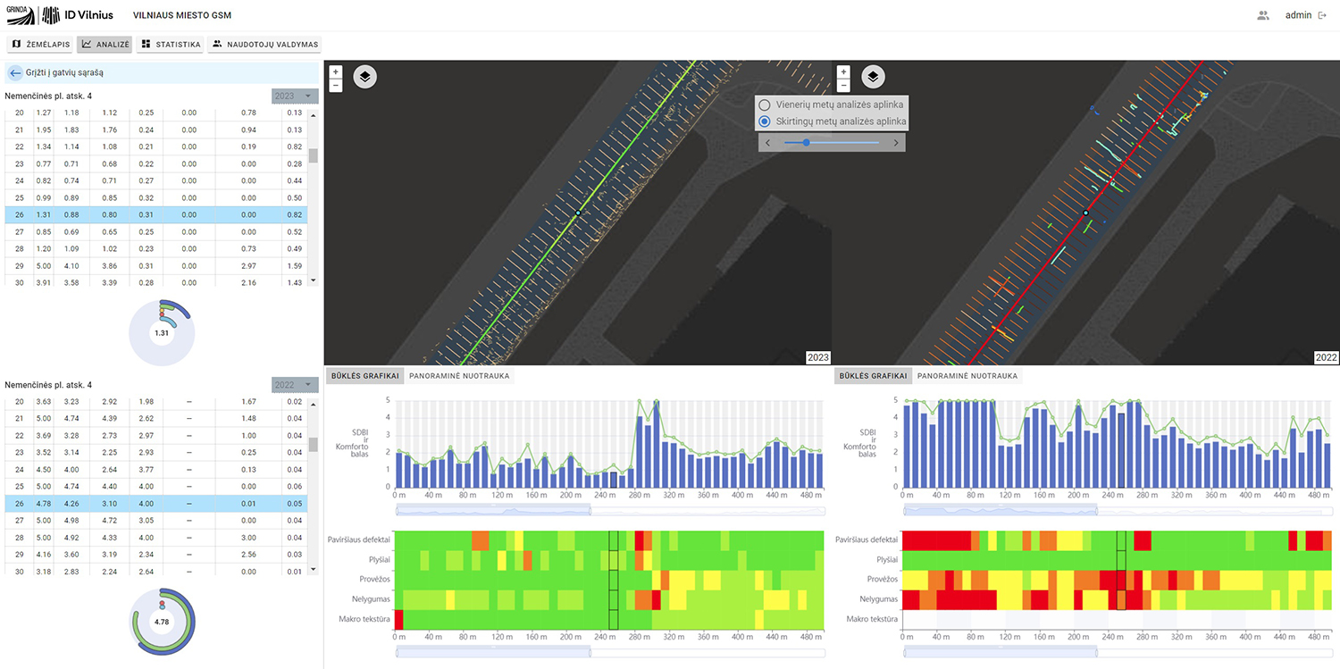
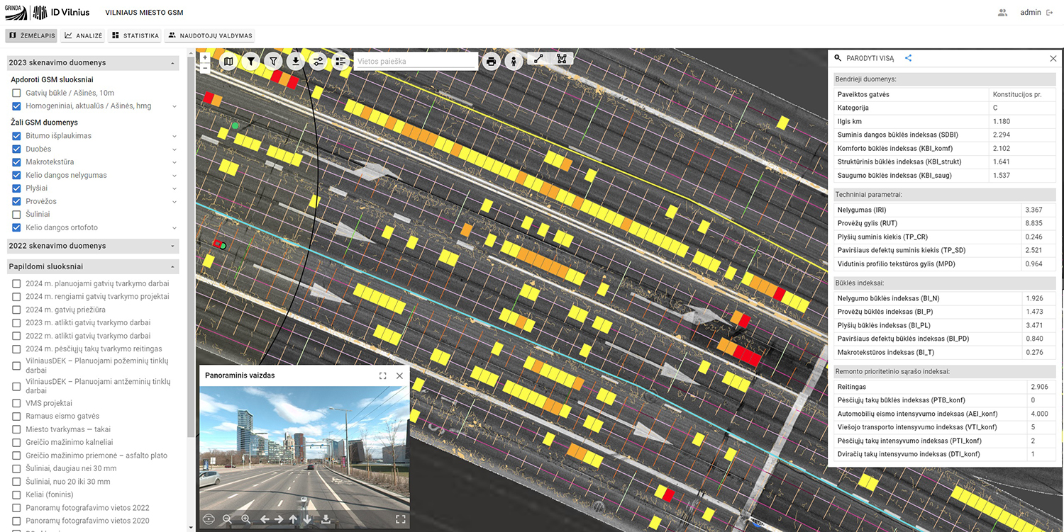
“We have developed an automated pavement condition assessment system that is internationally unique. It localises all scan data in real space and processes it using Geographical Information Systems. We have managed to accurately localise every pothole, patch or crack, which then allows us to overlay the data on top of each other or integrate the information with other data sources,” says Donatas Gudelis, Head of Product Development, ID Vilnius.
Almost 1,200 kilometres of streets scanned
Last year, 1,167.1 km of streets or 2,098 km of lanes were scanned with laser scanning. The laser captures a 4 m wide lane at a time. Specialised equipment enables the automatic detection and assessment of street pavement defects such as potholes, cracks, gullies, sunken manhole covers and other damage, as well as street defects and parameters.
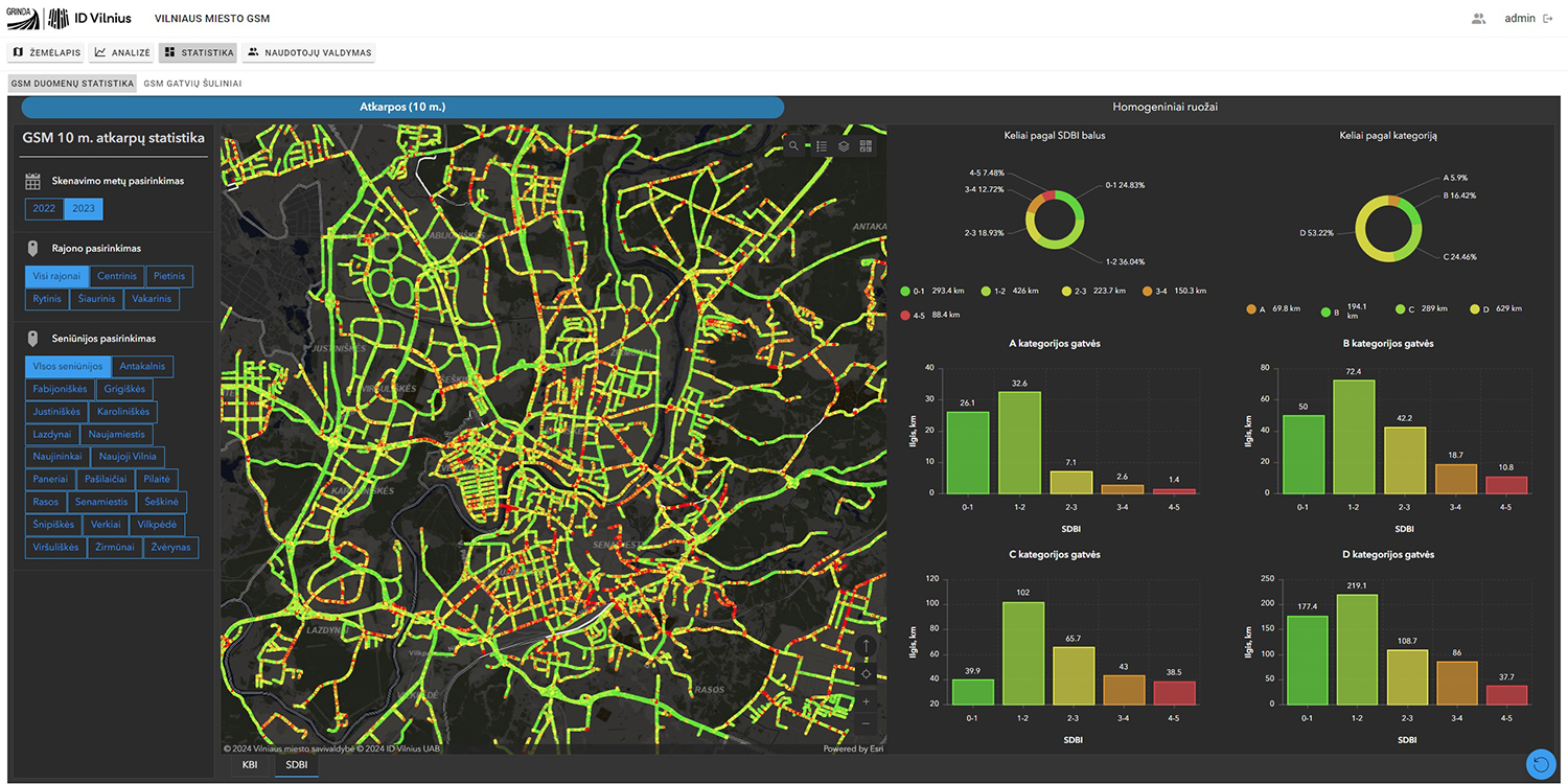
2023 m. For the first time, the condition of street structure and safety was also assessed separately. According to the laser scanning, Vilnius has 120 km of streets in poor condition and 44 km of streets in very poor (emergency) condition. The technical condition of the capital’s streets is assessed in three sections: comfort, structural and safety conditions, which are then used to calculate a total pavement condition index. A repair needs index is then calculated based on the volume of car traffic and the number of public transport passengers, and a list of streets to be maintained is drawn up.
Updated app and even more accurate data processing
Street scanning is carried out in a rather ordinary-looking van, which is fitted with an additional frame to mount the laser and the bump detection unit. The van houses the essential equipment that collects and processes the data. ID Vilnius, the data processing company, has substantially upgraded and improved the system by introducing spatial exceptions for even more accurate scanning of the street surface. For example, the system automatically recognises prominent crossings, fragmented pavement, etc. Between 2021 and 2022, 1009 km of the capital’s streets were scanned with the laser scanner, for a total of 2150 km in different lanes of traffic.