Today, we can’t imagine life without digital maps, which help us find the route we need, the place we need to go, and otherwise navigate our environment anywhere in the world.
They are compiled using advanced geographic information systems. GIS is a system for creating, managing and analysing spatial data. GIS is used in a wide range of fields, including architecture and urban planning. GIS has become increasingly important in architecture and urban planning in recent decades.
“GIS technologies can complement and extend the traditional field of architecture. For example, with two-dimensional plans still dominating spatial planning, the aim is to move towards 3D planning – a three-dimensional representation of the solutions in planning documents. This makes them more comprehensible for both professionals and citizens.

In addition, by using GIS, we can assess the impact of urban planning measures in advance and thus contribute to the management of broader urban development challenges,” says Matas Cirtautas, associate professor at the Department of Urban Planning, Faculty of Architecture, Vilnius University of Technology, and architect at the Territorial Planning and Sustainable Environment Department, UAB “Vilniaus Plan”.
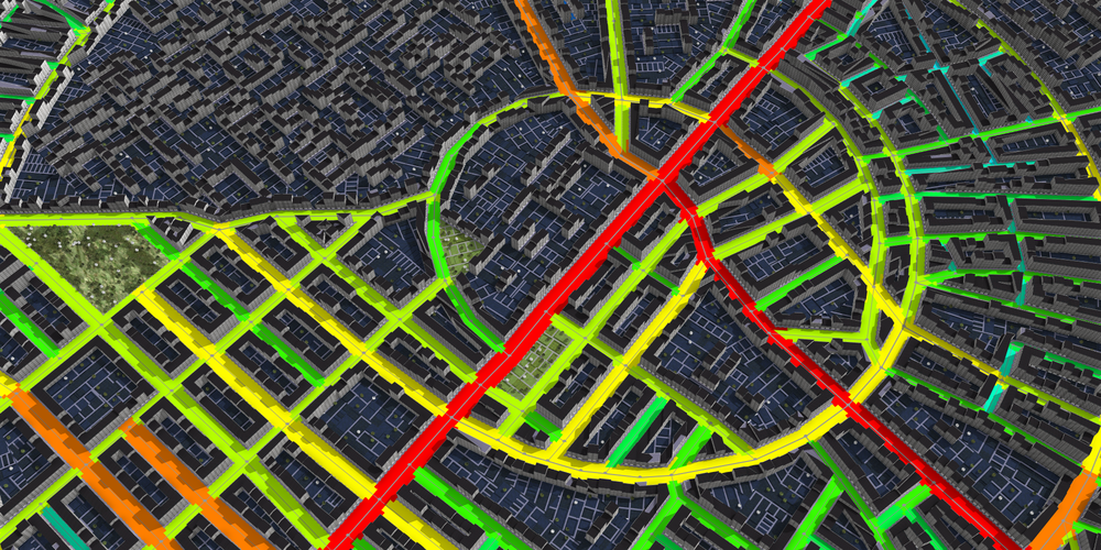
GIS is actively used in the Faculty of Architecture of VILNIUS TECH: in the study process and research. The application of geographic thinking in environmental design projects is referred to as geodesign. This interdisciplinary approach integrates architectural-urban creativity, analytical-scientific reasoning and GIS technologies.
Geodesign enables a more progressive and faster approach to urban problems and solutions. VILNIUS TECH Department of Urban Planning professors together with students apply a distinctive Geodesign approach based on innovative multi-criteria analysis and parametric modelling.

Multi-criteria analysis consists of methodically examining spatial phenomena and problems to understand their nature, detect and assess patterns of interaction, capture trends, predict progress and make data-driven decisions.
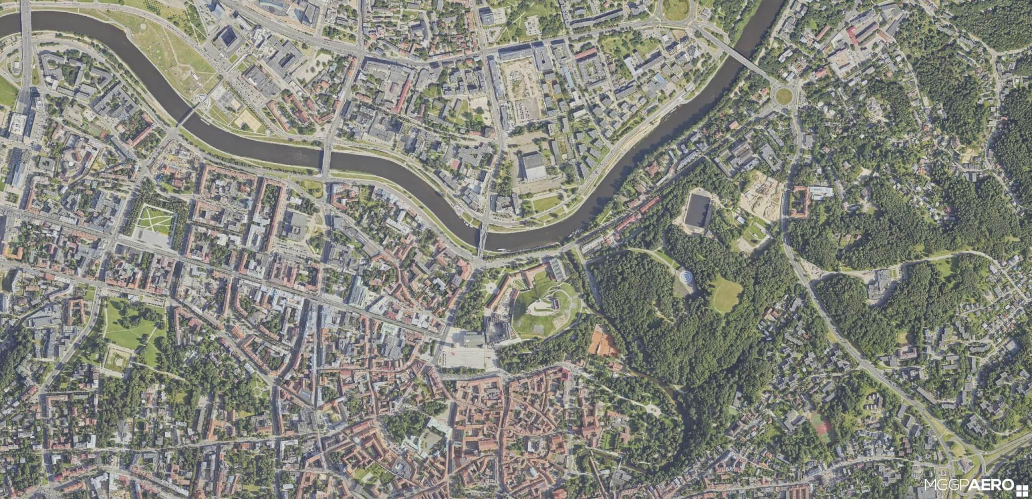
Parametric modelling is the computer-generated generation of three-dimensional models of the urban environment using sets of rules (procedures). This geodesign method uses a wide range of geographic data to gain a deeper understanding of the phenomenon under study, to create a digital twin of the urban environment, and to generate urban design proposals and impact assessments.
Every year, in cooperation with Vilnius Plan UAB and other organisations, students of the VILNIUS TECH Department of Urban Studies prepare innovative urban projects.
Students address complex issues such as the efficiency of the urban fabric as a prerequisite for coordinating the development of housing stock, or the compactness of the city as a priority for mitigating climate change.

The studies address issues and problems of interest to society at large, using GIS technologies.
The fact that GIS data and solutions can be creatively used in urban form research and in the search for ideas for shaping the urban environment is demonstrated by the successful performance of students in the ESRI Young Scientists Competition, where students from the Faculty of Architecture of VILNIUS TECH (https://www.gisbaltic.eu/lt-lt/gis-renginiai/esri-ys-konkursas) have been the winners for three years in a row.
Winners’ map stories:
- “Fabijoniškės Laboratory. The need for virtual tools in design”, authors. Matijošaitytė https://arcg.is/0z5mT0
- “Experiment on the identification and improvement of microclimatic zones in Vilnius” by L. Jusas, I. Meidutė, I. Augustinaitė, M. Beliavska https://arcg.is/14Dqym1
- “Vilnius – a collection of communities” by P. Kalugina, R. Petravičiūtė, J. Adomaitis, M. Urbonavičiūtė, I. Vigėlytė https://arcg.is/1GmHbi
These and other innovation-based works take on creative challenges that are less common in the context of architectural studies, but which are crucial to the role of architecture as a discipline and of architects as professionals in the field.
Matas Cirtautas, Associate Professor at the Department of Urban Studies, says: “In the context of the current urban development conditions, architecture and urban planning must address global challenges and issues.
Geodesign can be a method that responds to the complex nature of today’s cities and their increasing development uncertainty.”